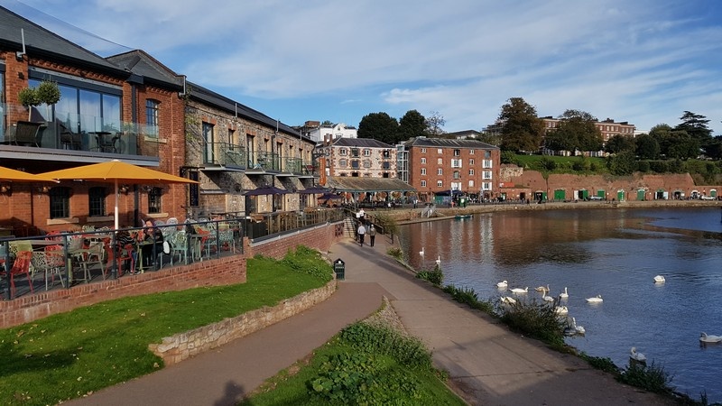
Exe Estuary Trail, E. Quayside to the Exe Estuary, Exeter

River Exe and Exe Estuary
The River Exe rises on Exmoor National Park's high moor. It flows through Mid Devon to Exeter where it meets the sea at the Exe Estuary.
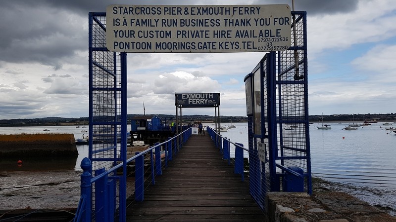
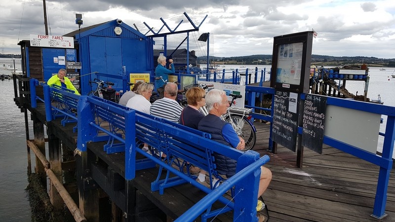
The Exe Estuary Trail is a multi-use recreational trail that runs around the side of the estuary. You can walk, run or cycle part, or all, of the Exe Estuary Trail. If you're planning to complete the entire route then you'll have to take a ferry across the water between Starcross and Exmouth. Consult the Starcross/Exmouth Facebook page for times and plan your trip around these.
Browse the photo gallery to see images of the Exe Estuary Trail.
How far is the Exe Estuary Trail?
In practice, there are many different routes you can take. The longest we've taken runs from Exeter to Starcoss and then Dawlish Warren before returning to Starcross for the ferry to Exmouth. From Exmouth, the route runs to Lympstone, Exton, Topsham and then back to Exeter via Lower Wear. Using the Ordnance Survey app, roughly speaking, this is a 24 miles trip.
The route we'd recommend taking, and that's outlined below, runs from Exeter to Starcross for the ferry to Exmouth and then back to Exeter via Lympstone, Exton and Topsham. Using the Ordnance Survey app, roughly speaking, this is a 19 miles trip.
If you have young children, you might just want to cycle the west side of the trail (this is all off-road and safe) from Exeter to Powderham just north of Starcross. Using the Ordnance Survey app, roughly speaking, this is a 13 miles trip there and back.
Clearly, you don't have to start at Exeter. For example, you can start at Exmouth or Darts Farm or Topsham or Starcross or Dawlish Warren.
How long will it take?
Depends which route you take and how long you wait for ferries to cross the estuary. The route outlined below in detail from Exeter to Starcross for the ferry to Exmouth and then back to Exeter via Lympstone, Exton and Topsham took 3 hrs 10 mins. Leisurely cycling time took 2 hrs 30 mins. Waiting for, and crossing the estuary on, the ferry took 40 mins.
What is the cycling like?
Easy. The trail is mostly flat. There are a handful of short uphill sections on the east side of the estuary. The trail is mostly tarmac or wooden boarding.
Is it family friendly?
Yes, most of the trail is off-road. The only area where one has to be super careful is between Exeter and Topsham on the east side of the Exe but you can avoid this by taking the ferry between Topsham and Topsham Lock. If your kids are very young, try just the trail on west side of the Exe and Exe Estuary between Exeter and Powderham just north of Starcross.
Where can I stay?
Exeter. See our 'Places To Stay' section. Exeter is small so Exeter Quayside is a short walk from any accommodation.
Topsham. See our 'Places To Stay' section.
Exmouth. Try one of the many hotels and B&Bs on the seafront.
Dawlish Warren. Dawlish Warren is an exceptionally popular holiday destination with plenty of holiday parks in which to stay.
Where can I hire bikes?
Exeter. Try Saddles & Paddles on Exeter Quayside.
Topsham. Try Darts Farm Bicycle Hire by Topsham.
Exmouth. Try Exmouth Cycle Hire
Dawlish Warren. Try Exe Trail Cycle Hire.
Where do I start?
We'd recommend you start from one of the main destinations on the trail.
Exeter. Start from Exeter Quayside.
Topsham. Start from the quays along Topsham.
Exmouth. Start from the seafront in Exmouth.
Dawlish Warren. Start from the train station area of Dawlish Warren.
Is it well signposted?
Most of the route is very well signposted and easy to follow. It can get a little tricky in the section east of the Exe between Topsham and Exeter.
A note of ferries
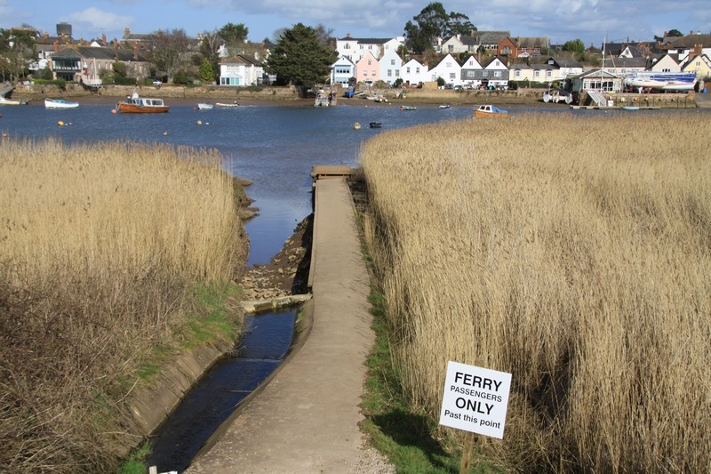
Ferries run across the estuary at Topsham/Topsham Lock, Topsham/Turf Lock and Exmouth/Starcross. If you want to ride around the estuary, you'll need to research ferry times. Estuaries are tidal so note that even if ferries are running, it might not be possible to take one at low tide.
Description of the Exe Estuary Trail excluding Dawlish Warren
Section 1. West side of the Exe Estuary
Hire bikes at Saddles & Paddles on Exeter Quayside. Staying on the east side of the River Exe, cycle down to the bridge beyond the weirs. This section of the trail in central Exeter is very busy so cycle slowly. Cross the bridge and follow the tarmac path on the west side of the River Exe until you come to a dog leg that takes you to the towing path for Exeter Canal. Follow this past the Double Locks pub to Countess Wear Bridge. Dismount as you have to cross the busy A379 at the traffic lights.
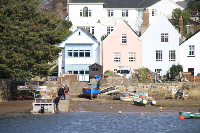
On the other side of the A379, cycle the west side of Exeter Canal past Old Sludge Beds Nature Reserve to the M5. Pass under the M5 and continue to Topsham Lock. This is a nice place to stop and take in the views of Topsham. Note that a ferry crosses the short stretch of river between Topsham Lock and Topsham.
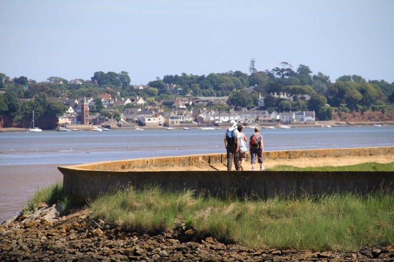
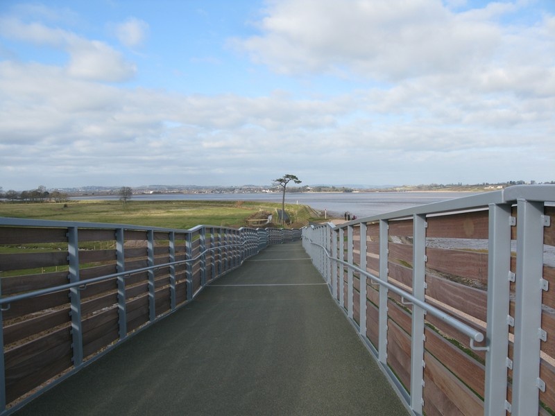
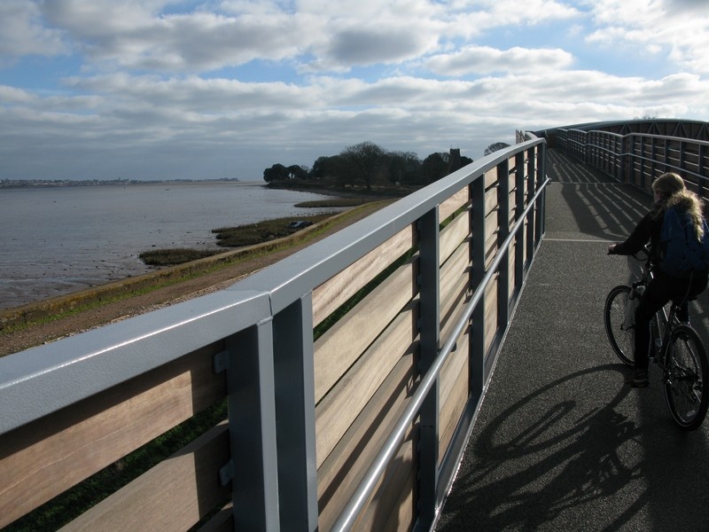
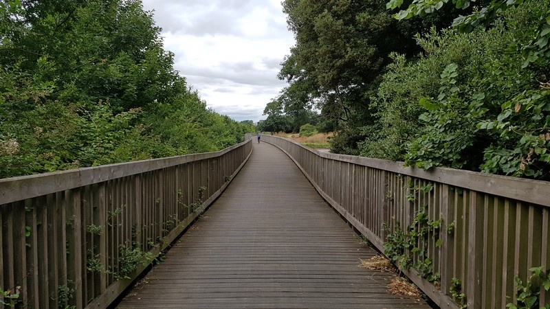
Continue on the west side of Exeter Canal to The Turf Hotel. The views down the Exe Estuary are superb. Note that a ferry crosses the estuary between The Turf Hotel and Topsham. From The Turf Hotel, follow the tarmac path to a relatively new bridge that climbs over the famous South Devon railway line. You'll come to Powderham and its church by the road. Follow the road down to Starcross. Powderham Castle and Estate are to your right. This section of the Exe Estuary Trail is on a public highway so take care.
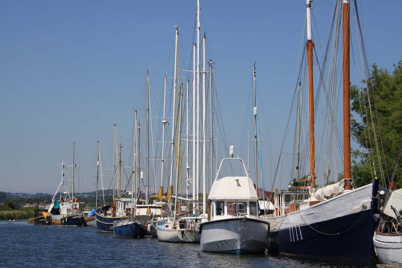
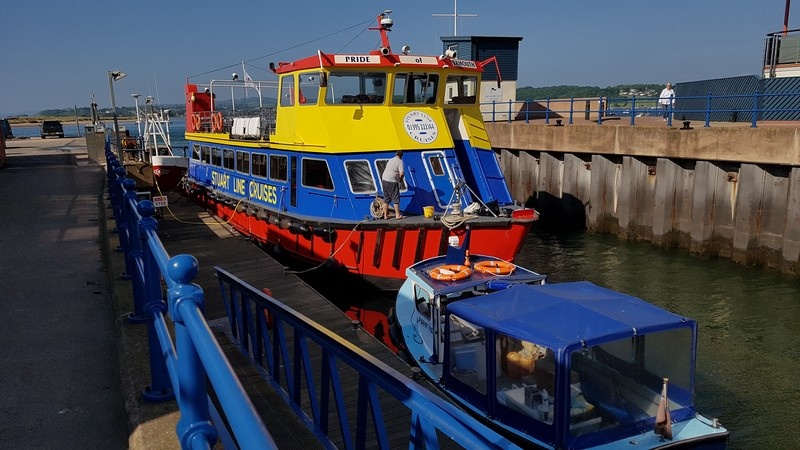
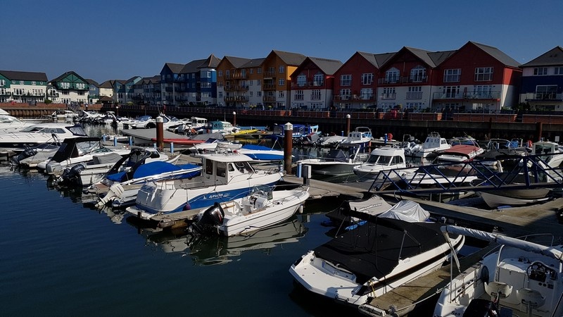
At Starcross, the trail leaves the road and runs by the train track to Starcross station. Dismount and carry your bikes over the bridge to the jetty to catch the Starcross to Exmouth ferry. The ferry curls past Dawlish Warren Nature Reserve to the entrance to Exmouth Marina. You are now on the east side of the Exe Estuary.
Section 2. East side of the Exe Estuary
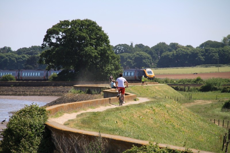
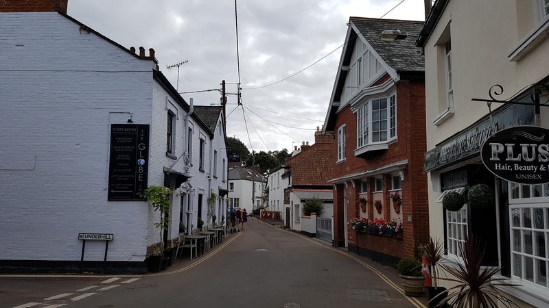
Cycle around the east/right side of Exmouth Marina up to Exmouth station. The trail runs along the side of the train track as you leave Exmouth and heads up to the pretty village Lympstone. This section between Exmouth and Lympstone is off-road. At Lympstone, cycle along the road past The Globe Inn until you come to Lympstone station. A steep hill takes you to more off-road trail that continues to the Commando Training Centre. Stop to read the information boards by the obstacle course.
Beyond the Commando Training Centre, you come to Exton. You are back on a road/public highway so take care. Cycle past The Puffing Billy Inn and turn left through Exton. The trail turns left and drops down to the edge of the Exe Estuary before climbing on an off-road stretch of wood boarding to Bowling Green Marsh Nature Reserve. There are plenty of view points from which to watch the birdlife.
The trail sweeps left and meets another road/public railway on the edge of Topsham. Climb the hill and drop down to the road that runs along the side of the estuary. Note that you pass The Passage House Inn and the Topsham to Topsham Lock ferry.
The last stretch of the trail follows the cycle route 2 by busy roads/public highways. It passes under the M5 to Lower Wear and then the A379 at Countess Wear Bridge. Cross the A379 and turn left to reconnect with the towing path by Exeter Canal on which you started. Retrace your route back to Exeter Quayside.
Photo Gallery